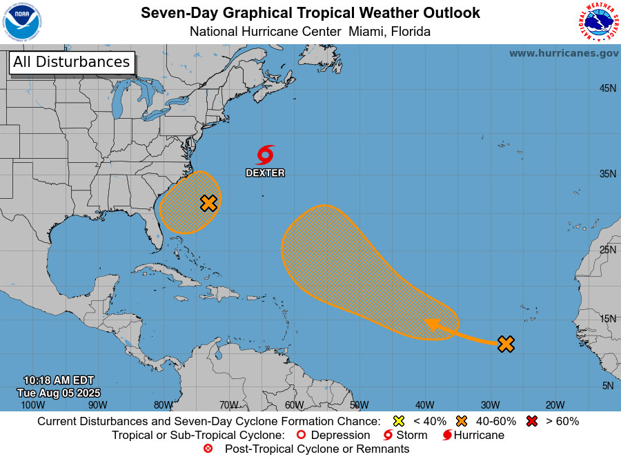
Over the next seven days, two meteorological systems, including one close to the southeast Atlantic coast, are being watched by the National Hurricane Center for possible tropical development. The likelihood of a tropical cyclone forming on Friday or Saturday has increased from 30% to 40%.
The Jacksonville National Weather Service stated this morning that an influx of tropical moisture and coastal convergence might raise the risk of flooding for coastal areas on Friday and Saturday, regardless of how this system develops. According to the Weather Prediction Center (WPC), coastal areas are at a Marginal Risk (level 1 out of 4) for flooding rainfall.
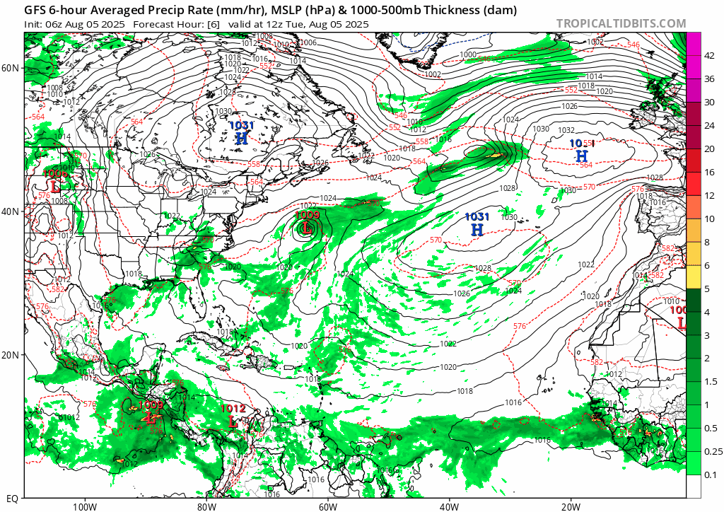
In seven days, there is a 50% chance that a tropical storm may form in another system that is presently in the eastern tropical Atlantic. By Monday, the weather system will still be unorganized as it moves over the Atlantic toward the Lower Antilles, according to the American forecasting model. By midweek of the following week, it will veer further to the north and make its way to the coast of North Carolina, where it will continue to develop into a more organized storm. The animation below shows the storm forecast for today through August 21.
For local beaches, onshore winds and developing easterly swells will keep the risk of rip currents at least moderate this week. By the weekend, if the surf is rough, some places may be at high risk. Along the I-95 corridor, from Coastal Georgia to Palm Coast and Flagler County, the National Weather Service is predicting a high likelihood of strong thunderstorms this afternoon and evening. These storms could bring with them heavy rainfall, frequent lightning, localized flooding, and wind gusts of up to 50 mph. The most likely storms would occur between 2:00 and 8:00 p.m. View the daily weather briefing from Jacksonville-NWS here.
This week’s temperatures will be close to normal, but next week they will be above average once more. NWS advises using the next few days to evaluate emergency preparations for homes and businesses, keep an eye on official weather forecasts, and, if needed, restock emergency supplies.
With a range of 13 to 19 named storms with speeds of 39 mph or higher, whether tropical storms or hurricanes, the hurricane center had forecast a 60% possibility of an above-normal hurricane season. Tropical Storm Dexter is presently circling south of Nova Scotia and moving northeast, away from the North American landmass, making it the fourth storm to be named thus far.
![]()
Tropical Tidbits’ forecast through August 21:
The Model of Europe: